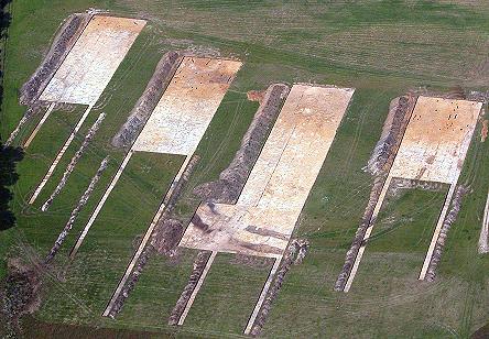
Photo 1
An aerial photographic overview of the excavations, seen from the
east. The photo shows (from right to left) trenches 1, 3, 5 and 7 (for scale,
all main trenches are 30 m wide). The extensions to the east of these main
trenches were designed to explore the area of relative higher and dryer ground
to the east of the larger enclosure and to the west of the Shirley Pool/Rushy
Moor SSSI wetland complex (see New for 2003).
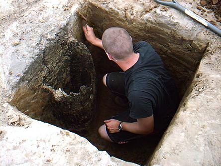
Photo 2
We have commenced excavating the large posts which formed the gateway belonging to the eastern entrance of the larger enclosure. As was the case last year, these large oak timbers have rotted inside-out, and sometimes leave little more than a ‘shell’ of wood. Some of these big timbers will have a well-preserved base, which provide crucial data for dendrochronological dating of the site. If we had postponed the excavation by, say, another 5 years, such a dating programme would have been much harder to complete, as most of these timbers would have been completely desiccated.
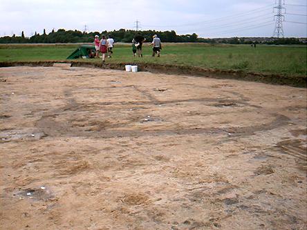
Photo 3
In week two, we found a small near-perfect-circular ditch (c. 2 m in diameter) in trench 5, and in week three we reported the find of a cremation in trench 7. We were unclear what this meant. However, this new discovery in trench 7 of a complex of narrow ditches suggests that we have a kind of cemetery on the site. This cemetery consist of a number of small ditched enclosures of basic geometric shapes and increasingly frequent fragmentary remains of cremations. If we include the small enclosure ditches found in 2002 (e.g. see photo 4 in the fourth week of excavation), then we may have some 20 such structures.
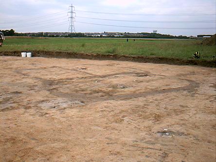
Photo 4
How this ‘cemetery’ was used requires further study, but these narrow ditches may have been up to 70 cm deep, enclosing small areas where the cremated remains were either buried or simply spread out over the surface of the small enclosed areas. Alternatively, the narrow ditches held a low wooden fence and the earth from the ditches were used to create low mounds, which have been flattened through wind erosion and agricultural activities in the post-medieval period. On the basis of the stratigraphy, this cemetery post-dates the structures belonging to the ‘marsh fort’, and are probably of late Iron Age date.