|
|
||||||
|
||||||
|
Home
> The
Cornish in Latin America > Maps and Graphs |
||||||
|
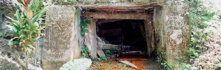
Visitors are politely reminded that the maps and graphs beneath are protected by copyright There has been very little quantitative analysis of Cornish migration, primarily due to the painstaking task of gathering sufficient data to create comprehensive records, as, unlike the Scottish, Welsh or Irish, the Cornish are not a clearly recognisable ethnic group, being classed as either English or British in official documentation. Breaking new ground, a unique database of 2,500 records of Cornish migration to Latin America (1811-1930) was assembled to analyse overseas migration flows from Cornwall. This was intended to supplement the considerable qualitative data that exists on Cornish migration in general, much of which has been a narrative of how the Cornish settled, shaped their communities and constructed their identity. This has taken precedence over the analysis of the migration process. Using nominal record linkage, this database was therefore set up to capture the complexity of demographic flows, including initial migration, return migration, repeat migration and immigration of people of Cornish descent to Cornwall, using Latin America as a case study. The data revealed fascinating results, some of which are depicted below cartographically and graphically. Cornwall, a peninsula at the far south west of the British Isles, could at no time in the nineteenth century boast a population more than half a million. Yet it was one of Europe's main emigration regions, estimated to have lost 118,500 people through overseas emigration in the last quarter of the nineteenth century: a figure equivalent to 40 per cent of its young adult males and over 25 per cent of its young adult females. According to demographer Dudley Baines, assuming that the rate of return to Cornwall was the same as to England and Wales as a whole, gross emigration would have been about 20 per cent of the male Cornish born population in each ten year period from 1861-1900, and about 10 per cent of the female. Although this was not as high as from the famous emigration regions of Italy, which exceeded 30 per cent per decade, mass emigration from Italy lasted only for a couple of decades. Apart from the Irish and Scots Highlanders, Cornishmen and women were the most likely to leave British shores. This map of Cornwall shows some of the main towns and mining settlements. By the early nineteenth century Cornwall was world renowned as a major metalliferous mining area which significantly altered the landscape. The main Cornish mining areas are depicted on this map. Migration to Latin America from Cornwall
was characterised by occupational specificity: over 60 per cent of
migrants were industrial workers, three quarters of whom were employed
in the mining industry in some capacity. It seems logical therefore to
seek their communities of origin in the mining districts. The number of
migrants with a known parish of departure was 1,235 that resulted in 95
per cent confidence intervals for point estimates that lie mainly within
the range plus or minus 2 per cent. The data was then plotted on a map
of Cornwall by
sub-registration district,
as the results for some parishes were too few to render them
statistically visible. What immediately becomes apparent is that migration
to Latin America was extremely heterogeneous with some mining areas
having pronounced demographic flows and others, little or none at all.
This points to the presence of discrete migration chains and opens up
intriguing avenues for further
research (more evidence of this is presented in the graphs below). Mining in Latin America has a long and
illustrious history. Many of the mining regions in which the Cornish
settled were already hundreds of years old and highly industrialised and
the towns and cities serving them boasted
beautiful colonial architecture built with the riches gained from
centuries of hard
rock mining. Guanajuato in Mexico, Potosí One of the most successful British mining
companies was the Copiapó
Mining Company. Set up in London, it began operations in 1836 in Chile's
Norte Chico, continuing until 1911. This map shows the mines
and estates of the company in
1836-7 that includes the legendary mines of Carrizal, Las Animas, Chañarcillo, and Cerro Blanco. The data that was used to
compile the graphs below was taken from an Access database containing
2,500 records. It has long been suspected that there were significant
differences in the timing and direction of migration flows from Cornwall
to various countries overseas. The graphs below confirm this observation
and highlight that while
the overall migration flow to Latin America from Cornwall was closely
governed by occupational specificity, the similarity ends there, for
there were startling differences in the timing and direction of the
flows from parishes only a few miles apart.
This
confirms the importance of analysing very variegated migration streams
at a very local level to explain mass mobility and mass immobility. Plotting the overall decennial migration flow from all Cornish parishes shows that migration there began very early in the nineteenth century, peaking before 1840, underlining the fact that this was the first significant overseas labour migration from Cornwall. Migration to the top four Latin American destinations from the top three Cornish sub-registration districts shows that people in parishes only a few miles apart went to very different destinations in Latin America, pointing to the existence of discrete migration chains or social networks. Decennial migration to Latin America from the sub-registration districts of Camborne, Redruth and Gwennap highlights the difference in the timing of migration flows from a small area of Cornwall. |
||||||